La Ceiba (La Ceiba)
 |
La Ceiba was officially founded on 23 August 1877. The city was named after a giant ceiba tree that grew near the old dock. The city has been officially proclaimed the "Eco-Tourism Capital of Honduras," as well as the "Entertainment Capital of Honduras". Every year, on the third or fourth Saturday of May, the city holds its famous carnival to commemorate Isidore the Laborer (Spanish San Isidro Labrador). During this time, the city is host to approximately 500,000 tourists.
In 1872 Manuel Hernández built a small shack under the Ceiba tree that grew near the old docks. Over time, more and more people from present-day Honduras (especially the departments of Olancho and Santa Barbara), and from around the world settled in La Ceiba. Workers were attracted to jobs associated with the banana industry, which became important to the regional economy.
In the late 19th century, the banana business caught the attention of big North American banana companies, such as the Vaccaro Brothers' Standard Fruit Company from New Orleans. This new economic activity attracted national and international immigrantworkers to La Ceiba. The current neighbourhood known as Barrio Inglés was the first recognised neighbourhood in the city. It was so named after the many English-speaking people living in the barrio. At that point the main thoroughfare of La Ceiba was present-day Avenida La Republica, where the train tracks were laid. The rail line was built by the Standard Fruit Company (now Standard Fruit de Honduras, a Dole subsidiary) for transport of its commodity to ships at the port from the banana plantations. This company was largely responsible for the early growth of the city.
La Ceiba was declared a municipality on 23 August 1877. At that time Marco Aurelio Soto was President of Honduras. La Ceiba was the centre of banana and pineapple business, the basis of its economy. Other companies developed in the city, such as:
The first municipal building or city hall was located in the corner of 2da Calle and Avenida Atlántida, at the site of the present-day Ferretería Kawas warehouse. The building was made of wood and in 1903 it was burnt down due to vandalism. Some people wanted to destroy private property ownership records in La Ceiba. The municipal building was set on fire again on 7 March 1914 during more social unrest.
* Cervecería Hondureña, the national brewing company and holder of the Coca-Cola licence in Honduras. Founded in 1918.
* Fábrica de Manteca y Jabón Atlántida, known as La Blanquita, at one point, this was the largest producer of consumer goods in Honduras; it is now defunct.
* Banco Atlántida, oldest Bank in the country, founded in 1913.
* Mazapan School, the first bilingual school of the nation, the oldest high school and second oldest elementary school in the city.
Map - La Ceiba (La Ceiba)
Map
Country - Honduras
 |
 |
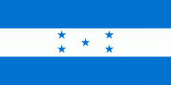
| Flag of Honduras | |
Honduras was home to several important Mesoamerican cultures, most notably the Maya, before the Spanish colonization in the sixteenth century. The Spanish introduced Catholicism and the now predominant Spanish language, along with numerous customs that have blended with the indigenous culture. Honduras became independent in 1821 and has since been a republic, although it has consistently endured much social strife and political instability, and remains one of the poorest countries in the Western Hemisphere. In 1960, the northern part of what was the Mosquito Coast was transferred from Nicaragua to Honduras by the International Court of Justice.
Currency / Language
| ISO | Currency | Symbol | Significant figures |
|---|---|---|---|
| HNL | Honduran lempira | L | 2 |
| ISO | Language |
|---|---|
| ES | Spanish language |


